
Pacific seafaring
Polynesian seafarers and the science of wayfinding
Polynesian voyaging joined remote islands across a vast ocean without magnetic compasses, chronometers or modern charts. Its success depended on capable canoes, memorized spatial systems, close observation of sky and sea, social organization and generations of accumulated environmental knowledge.
Polynesian voyaging emerged from a much older Austronesian expansion
Polynesian seafaring belongs to a larger Austronesian history that began in island Southeast Asia and moved eastward through Near Oceania into Remote Oceania. Linguistic, archaeological and genetic evidence traces successive settlement movements through the Pacific, with Lapita culture providing an important archaeological horizon for early settlement in parts of Remote Oceania.
Over centuries, communities adapted vessels, crops, social systems and navigation knowledge to increasingly remote island environments. Polynesian societies later occupied an enormous triangle commonly described by Hawaiʻi, Aotearoa/New Zealand and Rapa Nui. Each settlement required intentional movement of people, food plants and often domesticated animals across open ocean.
Voyaging canoes were engineered for range and resilience
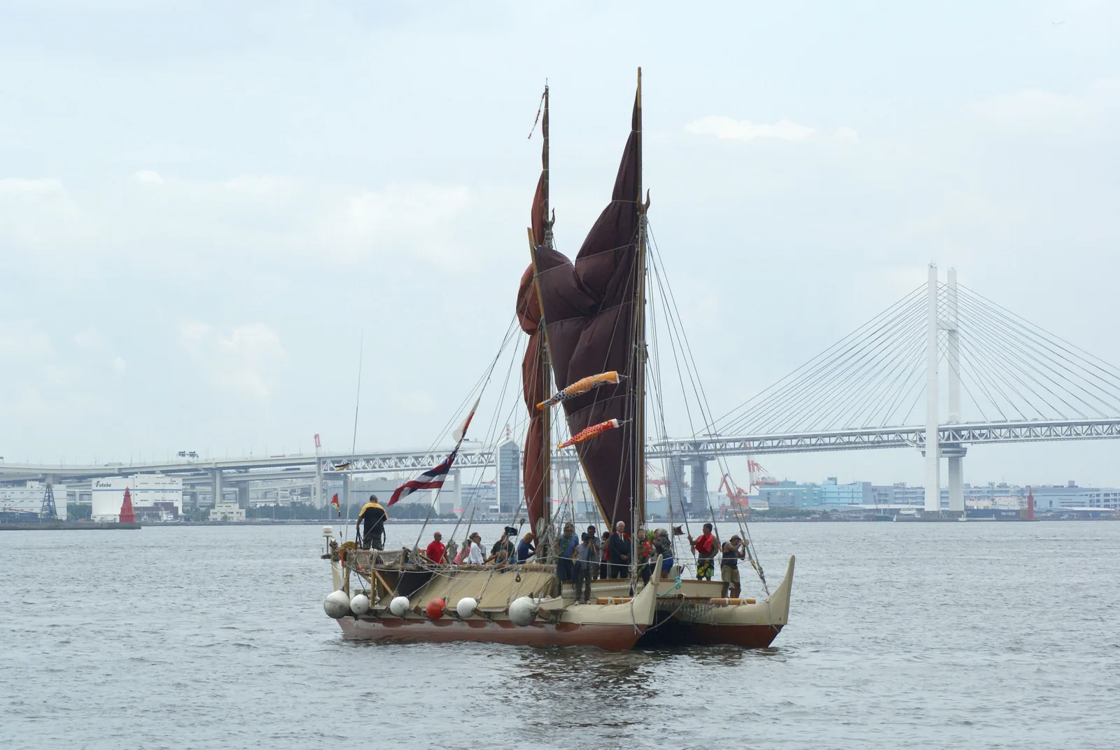
Large double-hulled canoes and related regional forms created stable sailing platforms with space for crew and supplies. Construction relied on carefully shaped timber, lashings, fibre cordage and sails made from local materials. The absence of metal fasteners did not make these vessels primitive. Their construction reflected materials, repair practices and marine environments very different from those of European plank-built ships.
Voyaging craft varied across islands and periods, so no single reconstruction should stand for all Polynesian vessels. Modern canoes such as Hōkūleʻa are best understood as historically informed working vessels that demonstrate practical possibilities while also participating in a living cultural revival.
The star compass organized direction without drawing a map
Navigators memorized the rising and setting positions of stars and used them as directional references. A star that rose in a useful direction could guide the canoe until it climbed too high or disappeared, after which another celestial reference could take over. The system required familiarity with many stars and their seasonal visibility.
The phrase “star compass” can sound like a physical instrument, but in Polynesian wayfinding it refers to a mental framework. Directional houses or sectors organize where celestial bodies rise and set, allowing the navigator to maintain orientation even without a drawn chart.
Swells allowed orientation when stars disappeared
Open-ocean swells can persist across long distances and may come from weather systems far from the canoe. Experienced navigators learn recurring swell directions and how the canoe moves across them. At night or under cloud, these wave patterns can provide a directional reference when celestial cues are unavailable.
Interpreting swells is difficult because local wind waves and multiple swell systems can overlap. The skill lies in separating persistent background patterns from temporary surface conditions. This is a learned sensory practice that cannot be reduced to a simple rule such as “feel the waves and turn east.”
Birds, clouds and ocean colour aided landfinding
As a canoe approached an island, navigators could look for birds that feed offshore but return to land, cloud formations influenced by islands, reflected lagoon colour, floating vegetation or changes in wave behaviour around reefs. These signs extend the effective detection zone of an island beyond the distance at which land itself becomes visible.
No single cue is infallible. Birds may travel far from land, cloud behaviour changes with weather, and reefs create hazards as well as clues. Wayfinding works because navigators combine several observations and continuously compare them with an internal model of the voyage.
Navigation also required an estimate of progress
Maintaining direction is only part of open-ocean navigation. A navigator also needs a sense of how far the canoe has travelled and where the destination should lie relative to the current position. Traditional systems use observations of speed, elapsed time, sea state and directional changes to maintain a mental track.
This process resembles dead reckoning in purpose, but it is embedded in a different cultural framework. The navigator does not need a latitude-longitude coordinate to reason about position. What matters is maintaining a coherent relationship among departure, destination, environmental cues and the canoe’s accumulated movement.
Voyages moved living systems, not only people
Settlement voyages carried plants such as taro, breadfruit and yam, together with animals and tools needed to establish communities. Water storage and food provisioning therefore mattered as much as navigation. A successful voyage had to deliver viable people and resources, not merely reach land.
This logistical dimension helps explain why repeated settlement cannot be dismissed as accidental drifting. Accidental voyages happen, but the planned movement of families, crops and animals requires preparation, vessel capacity and social decisions made before departure.
Mau Piailug and Hōkūleʻa changed modern understanding
By the twentieth century, many traditional navigation practices had been disrupted by colonial systems and modern technology. The Polynesian Voyaging Society’s Hōkūleʻa project became a major effort to recover and demonstrate non-instrument voyaging. Micronesian master navigator Mau Piailug shared navigational knowledge, while Nainoa Thompson developed Hawaiian wayfinding practice within the revival.
The 1976 Hōkūleʻa voyage from Hawaiʻi to Tahiti became a landmark because it demonstrated that a double-hulled voyaging canoe could complete a long Pacific passage using traditional-style non-instrument navigation. The project influenced scholarship, education and cultural identity across the Pacific.
The debate over settlement routes is an evidence problem, not a challenge to capability
Researchers continue to refine the chronology and exact pathways of Polynesian settlement. Winds, currents, archaeological dates, language relationships and genetic data all contribute. Experimental voyages help test what routes are physically possible, but they cannot by themselves prove which exact route a particular ancient crew sailed.
The central historical conclusion is secure: Polynesian communities repeatedly crossed large ocean distances and settled remote islands. The interesting questions now concern timing, direction, exchange networks and how specific traditions varied among island groups.
Evidence, chronology and the limits of reconstruction
The maritime history of Polynesian Seafarers and Wayfinding has to be reconstructed from evidence that survives unevenly. Ports, imported ceramics, anchors, inscriptions, coins, ship remains and foreign accounts can each establish part of the picture, but none can carry the whole argument alone.
An imported object proves movement or exchange. It does not by itself identify the crew, establish one direct voyage or prove political control. Chronology matters because ports shifted, dynasties changed and vessel traditions evolved.
What sustained regular participation in sea travel
Regular seafaring required an economy behind the waterfront. Crews needed water, food, repair materials, pilots and seasonal knowledge, while shipwrights needed timber, fibres, tools and skilled labour.
Merchants depended on storage, credit, brokers and trusted partners across languages and political borders. Maritime strength is therefore better understood through working systems than unsupported fleet claims.
How this tradition fits the wider history of sea travel
Polynesian Seafarers and Wayfinding belonged to connected seas rather than an isolated national story. Cargo often changed hands several times, and sailors borrowed useful practices from neighbouring communities while retaining local traditions.
Political influence could cross water without becoming territorial rule. Comparing maritime systems makes local solutions clearer because every seafaring society faced recurring problems of weather, navigation, provisioning, harbour access and risk.